In the fast-paced world we live in, technology often serves as our trusty companion, helping us streamline various aspects of our daily lives. One common scenario that many of us have faced is the momentary lapse of memory when trying to locate our parked cars in bustling parking lots.
Fortunately, with the advent of innovative applications like Google Maps, the days of wandering aimlessly in search of your vehicle are a thing of the past.
In this guide, we’ll walk you through the comprehensive step-by-step process on how to find a parked car’s location on Google Maps.
Also Read: How To Manually Save Parking Location On Google Maps
How To Find Parked Car’s Location On Google Maps
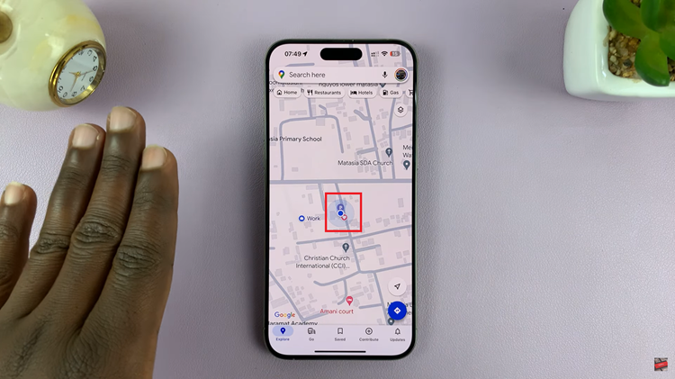
The first step is to open the Google Maps app on your smartphone. Once Google Maps is open, make sure your location services are enabled. Look for the blue dot on the map, which represents your current location. This is crucial for accurately tracking your movements.

To locate your parked car, you’ll need to use the Parking icon in Google Maps. This icon appears automatically when the app detects that you’ve parked your car. It’s a small “P” symbol that appears on the map.
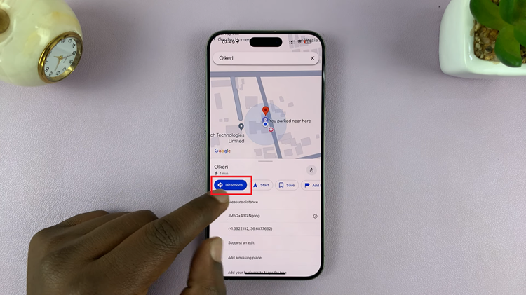
After spotting the Parking icon, tap on it to reveal additional options. You’ll see a menu that includes “Directions” among other choices. Select the “Directions” option to proceed to the next step.

Once you’ve selected “Directions,” Google Maps will generate a route from your current location to where you parked your car. The app will provide step-by-step directions, guiding you through the most efficient route to reach your vehicle.
With Google Maps’ built-in feature for finding your parked car, the days of wandering aimlessly in search of your vehicle are over. By following these simple steps, you can easily track down your car in a crowded parking lot, saving you time and alleviating the stress associated with forgetting where you parked.

