Google Maps has revolutionized the way we navigate and explore the world around us. Beyond its primary function as a navigation tool, Google Maps offers a plethora of features, one of which is the ability to measure distances.
Whether you’re planning a road trip, estimating the length of a hiking trail, or measuring the dimensions of a property, Google Maps can serve as a convenient and accurate distance measurement tool.
In this article, we’ll guide you through the steps to measure the distance using Google Maps.
Watch: How To Send Instant Video Messages On WhatsApp
To Measure Distance Using Google Maps
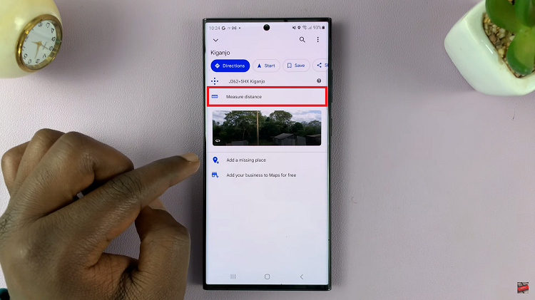
First, launch the Google Maps app on your device. Make sure you’re signed in to your Google account. Next, long press on the location where you’d like to measure the distance. Now, swipe up to reveal the options, then select “Measure distance.”

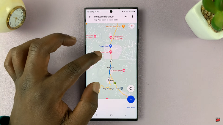
From here, place waypoints on the map from the starting point by tapping on the “+” icon or selecting “Add Point” at the bottom right of the screen. As you continue to add waypoints or modify your path, Google Maps will dynamically update the distance measurement.

Once you reach the desired destination, you’ll see the distance displayed on the bottom left corner of the screen. By following the steps outlined in this guide and considering the provided tips, you can confidently measure distances using Google Maps and enhance your navigational capabilities.

